IB Geography • Section 2
Interactions between Oceans and Coastal Places
How coastal places are shaped by their interactions with oceans
Restored from the original AdornGeo Weebly page • syllabus order preserved
Forces on the Coast: Waves, Tides & Littoral Drift
Physical influences on coastal landscapes, including waves, tides, sediment supply, lithology, vegetation, subaerial processes and wave processes (littoral drift, hydraulic action and abrasion)
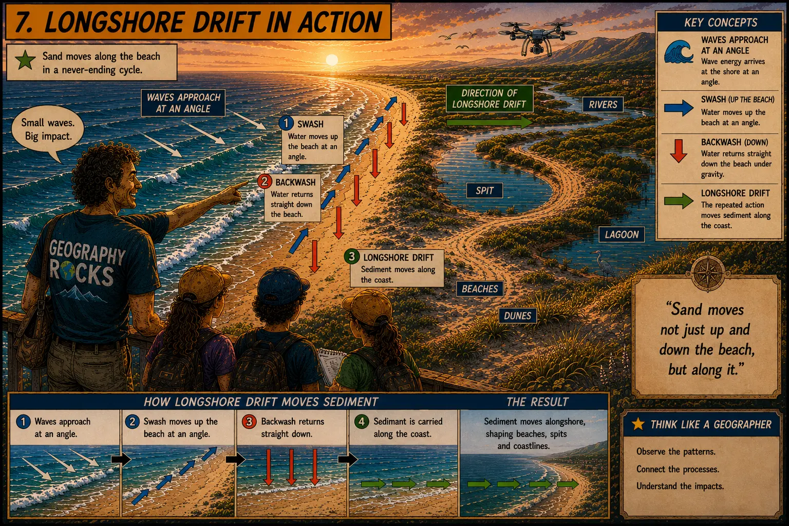
Start with the coast as a dynamic system. Work through the original AdornGeo lesson deck and reading, then use the videos and longshore-drift visual to connect wave energy, tides and sediment movement to the shape of real coastlines.
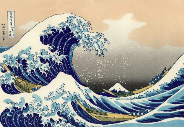
- Wave action transfers wind energy to the coast; fetch, wind strength and duration influence wave energy.
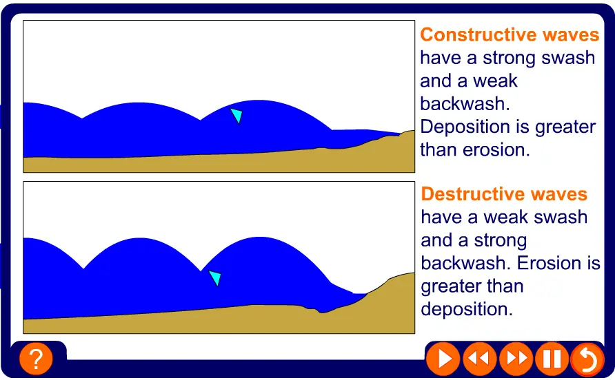
- Constructive and destructive waves move sediment differently through the balance between swash and backwash.
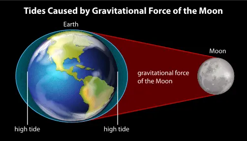
- Tides change the vertical zone in which marine processes operate and can strongly influence estuaries and mudflats.
- Littoral (longshore) drift transports sediment along the coast when angled swash is followed by downslope backwash.
- Lithology, sediment supply, vegetation and subaerial processes interact with marine processes rather than acting in isolation.
Watch: Coastal systems — original lesson starter
Watch: Ocean waves — original lesson video
Watch: Constructive and destructive waves — original lesson video
Watch: Bay of Fundy tides — original lesson video
Watch: Tidal processes — original lesson video
Watch: Littoral / longshore currents — original lesson video
Coastal Erosion, Deposition & Landforms
The characteristics and formation of coastal landforms of erosion and deposition, including wave-cut platform, cliff, stack, spit and beaches
Move from processes to products. The original sequence uses landform 'life stories', sketching and exam-style explanation so students do more than identify features: they explain the linked processes that create them over time.
- Hydraulic action and abrasion exploit weaknesses and help drive cliff retreat and the cave–arch–stack–stump sequence.
- Differential erosion of contrasting lithology can create headlands and bays; wave refraction concentrates energy on headlands.
- Wave-cut notches, cliff collapse and retreat leave wave-cut platforms.
- Deposition occurs where energy falls; sediment supply and littoral drift help build beaches and spits.
- Strong IB answers use annotated diagrams and a clear sequence of process → change → landform.
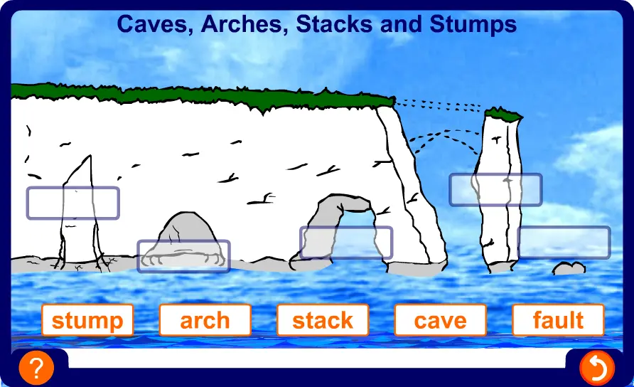
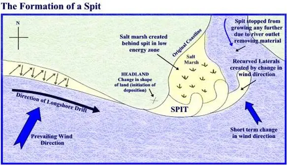
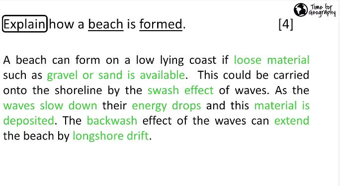
Watch: Coastal landforms — original lesson video
Watch: Erosion and deposition — original lesson video
Watch: Cake by the Ocean — modelling coastal landforms
Advancing & Retreating Coastlines
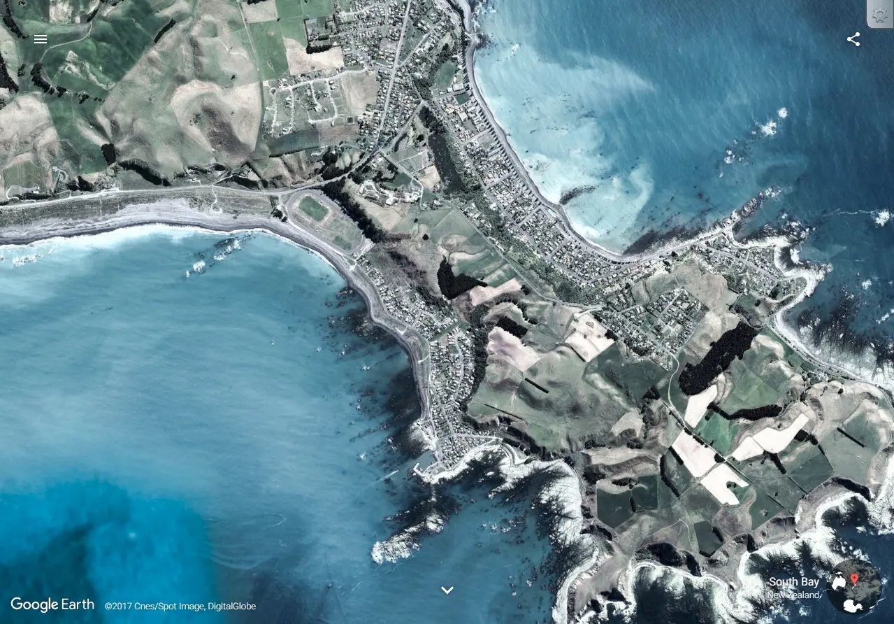
Advancing and retreating coastlines, including the role of isostatic and eustatic processes, and the associated landforms (relict cliff, raised beach, fjord)
Now change the timescale. Relative sea level changes when the ocean surface rises or falls (eustatic change), when the land itself rises or falls (isostatic change), or through a combination of both. The key is to connect the process to evidence preserved in the coastal landscape.
- Eustatic change alters global sea level, for example through melting land ice or thermal expansion.
- Isostatic change alters land level, including post-glacial rebound after the removal of an ice load.
- Emergent coastlines can preserve raised beaches and relict cliffs above the modern shoreline.
- Submergent coastlines include drowned glacial valleys (fjords) and other flooded lowland landscapes.
- For Bangkok, distinguish global sea-level rise from local subsidence: relative sea-level risk reflects both.
Watch: Sea-level change — original Oceans unit video
Sand Dune Development & Coastal Protection
The role of coastal processes, wind and vegetation in sand dune development
Finish by linking the ocean, atmosphere and biosphere. Use the original deck and reading to follow sediment from beach to embryo dune to a more stable dune system, then consider why dunes matter as dynamic natural coastal protection.
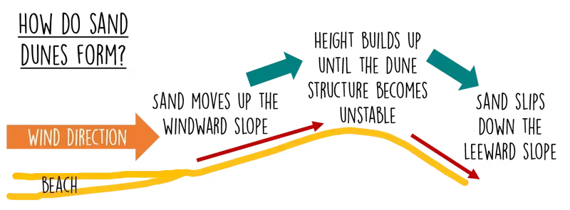
- Dunes need a wide sediment source, dry sand and sufficiently strong onshore wind.
- Saltation and suspension move sediment landward; debris and pioneer plants begin to trap it above the strandline.
- Vegetation such as marram grass stabilises dunes by binding sand with roots and trapping new sediment above ground.
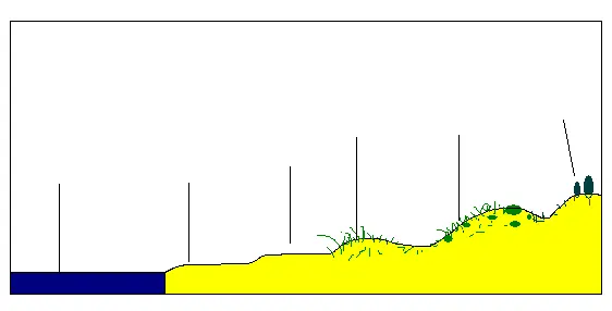
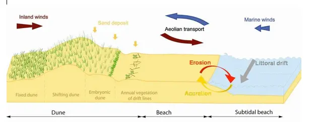
- Succession can create embryo, fore, mobile and fixed dunes with increasingly developed vegetation and soils.
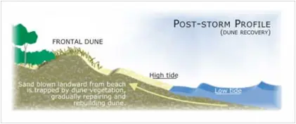
- During storms dunes can sacrifice sediment to offshore bars and later rebuild, making them a dynamic buffer rather than a fixed wall.
Watch: Sand dunes — original lesson starter
Watch: The process of saltation — original lesson video
Watch: Sand dune recap — original lesson video