IB Geography • Section Option G • Section 1
The Variety of Urban Environments
The characteristics and distribution of urban places, populations and economic activities
Restored from the original AdornGeo Weebly page • syllabus order preserved
Characteristics of Urban Places
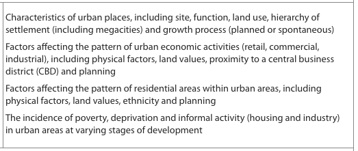
Characteristics of urban places, including site, function, land use, hierarchy of settlement (including megacities) and growth process (planned or spontaneous).
The original AdornGeo lesson begins by treating a city as a distinctive place rather than simply a large settlement. Students investigate how site, function, land use, connectivity, population and sphere of influence combine to produce very different urban environments.
- Site describes the physical setting of a settlement; situation describes its connections to other places.
- Urban function may be administrative, industrial, commercial, transport, cultural, religious or mixed, and can change over time.
- A settlement hierarchy orders places by population, service range and sphere of influence, from hamlets to world cities.
- Megacities have more than ten million inhabitants, but size alone does not explain their global importance.
Urban place profile
- Use the original characteristics activity to build a profile of one familiar city and one contrasting city.
- Annotate each city with site, situation, functions, major land uses, population and position in the settlement hierarchy.
- Use the megacity story map to identify where the fastest urban growth is occurring and suggest two reasons for the pattern.
- Conclude which characteristic best explains each city's present-day importance.
Quizlet: Urban characteristics key terms
Settlement Hierarchy and Urban Growth
Hierarchy of settlement, including megacities, and urban growth processes that may be planned or spontaneous.
The recovered page moves from hierarchy to contrasting growth processes. Its original videos make planned cities and rapidly expanding informal neighbourhoods visible, allowing students to compare intention, speed, infrastructure and lived experience rather than learning the terms in isolation.
- Higher-order settlements provide more specialised services to larger hinterlands, but digital connections complicate a simple hierarchy.
- Planned growth uses zoning, transport and infrastructure decisions to direct the shape and timing of development.
- Spontaneous growth occurs ahead of, or outside, formal planning and often reflects unmet demand for affordable land and housing.
- Informal does not mean disorganised: residents create homes, services, businesses and social networks under severe constraints.
Planned or spontaneous?
- Watch the three planned-settlement examples and record their stated goals, layout, infrastructure and evidence of government control.
- Compare them with the two Rio favela films using housing, accessibility, services, security and resident agency.
- Construct a continuum rather than a binary: place each example between completely planned and completely spontaneous.
- Evaluate the claim that planned growth always creates a better urban environment.
Watch: Planned urban development: original AdornGeo example
Watch: A planned city: original AdornGeo example
Watch: Putrajaya: an intelligent garden city
Watch: Inside Rio's favelas
Watch: Spontaneous urban growth: original AdornGeo example
Watch: Urban characteristics summary
Patterns of Urban Settlement
The distribution of land uses within urban places and the usefulness and limitations of urban land-use models.
The original page places the classic urban models after the introductory growth material. Students use them as hypotheses to test against real cities, not as diagrams to memorise. The surviving lesson contrasts North American, Latin American, Southeast Asian and sub-Saharan African patterns.
- Burgess, Hoyt and multiple-nuclei models simplify how accessibility, land value and transport shape land use.
- Regional models reflect different colonial histories, income patterns, informal growth and transport systems.
- Real cities contain several overlapping patterns and frequently depart from the model because of physical barriers and planning.
- A useful model draws attention to relationships; it is not expected to reproduce every street or neighbourhood.
Model, map, test
- Use the original information sheet to summarise the assumptions behind the three classic models.
- Watch the recovered model videos, then complete the New York reading and land-use analysis activity.
- Compare the Latin American, Southeast Asian and sub-Saharan African models and identify the process that creates each distinctive feature.
- Select one model and test it against satellite imagery of a city you know. Annotate matches, exceptions and missing processes.
Watch: Urban land-use patterns
Watch: The Burgess concentric-zone model
Watch: Urban models and city structure
Watch: Land use and the urban transect
Watch: Comparing urban land-use models
Economic and Residential Patterns
Factors affecting the pattern of urban economic activities and residential areas, including physical factors, land values, proximity to the CBD, ethnicity and planning.
The original resources bring the two patterns together: jobs and services influence where people live, while income, identity, household stage and planning influence what housing is available and who can access it. Students build an explanation from interacting factors rather than assuming a single universal pattern.
- Retail seeks accessible locations and thresholds of customers; industry balances land, transport, labour and externalities.
- High land values encourage intensive uses near highly accessible centres, although edge cities and online retail modify the pattern.
- Residential patterns reflect income, housing supply, transport, ethnicity, planning and the changing needs of households.
- The family life cycle can influence location, but it must not be treated as a universal or culturally neutral sequence.
Explain an urban fingerprint
- Complete the original economic-activity task and map where retail, offices, manufacturing and logistics would compete for land.
- Use the residential reading to create a causal web linking land value, transport, physical environment, ethnicity and planning.
- Apply the family-life-cycle activity to three contrasting households, then identify where the model risks stereotyping urban residents.
- Write one PEEL paragraph explaining a visible urban pattern with at least three interacting factors.
Poverty, Deprivation and Slums
The incidence of poverty and deprivation in urban areas at varying stages of development.
The original sequence distinguishes income poverty from multidimensional deprivation before examining their spatial concentration. Its videos, presentation, Detroit activity and UN-Habitat reading allow students to compare experiences in cities at contrasting stages of development without equating every low-income neighbourhood with a slum.
- Poverty concerns insufficient resources; deprivation is a wider lack of housing, health, education, safety, services and opportunity.
- Urban averages hide strong neighbourhood inequalities and can conceal groups living beside wealth but excluded from it.
- UN-Habitat identifies slum households through deficits in durable housing, space, water, sanitation and secure tenure.
- Deprivation patterns are produced by labour markets, housing costs, discrimination, service provision, environmental risk and policy.
Read deprivation as a pattern
- Watch the introductory films and define poverty, deprivation and inequality using distinct examples.
- Use the original presentation to describe clustered, core-periphery and pocket patterns of deprivation.
- Complete the Detroit activity and compare its causes with evidence from one rapidly urbanising city.
- Evaluate whether the word slum clarifies living conditions or oversimplifies diverse communities.
Watch: Understanding urban poverty
Watch: Urban deprivation: original AdornGeo video
Watch: Patterns of urban poverty
Watch: Living with urban deprivation
Watch: Urban inequality and place
Watch: What makes a slum?
Watch: Life and change in informal settlements
The Informal Sector
The incidence of informal activity, including housing and industry, in urban areas at varying stages of development.
The original page follows housing deprivation with the informal economy. This matters because informal work is not a marginal exception: it provides employment, goods and services for large urban populations while often lacking legal protection, secure premises, finance and social security.
- Informal activity is not fully regulated, taxed or protected by formal labour and business systems.
- Street trade, repair, transport, domestic work, recycling and home production can make cities function and provide flexible livelihoods.
- Workers may face insecure income, unsafe conditions, eviction, harassment and exclusion from finance or social protection.
- Formal and informal sectors are interdependent through supply chains, customers, subcontracting and waste recovery.
Formal–informal city audit
- Begin with the original sorting activity and justify any example that could fit both categories.
- Watch the two original films and record economic, social and environmental contributions made by informal workers.
- Draw a flow diagram connecting one informal activity to formal firms, customers and city government.
- Design a policy that improves safety and rights without removing livelihoods, then identify likely stakeholder conflicts.
Watch: The informal economy
Watch: Informal workers and urban livelihoods
London Urban Characteristics Case Study
A located synthesis of urban characteristics, land use, economic and residential patterns, diversity and deprivation.
London is the original page's concluding case study. It brings the entire section together: a river and bridging-point site, changing imperial and global functions, a polycentric land-use pattern, international migration, very high land values and sharply uneven deprivation.
- London's site on the Thames and its national and global situation supported trade, government and later world-city functions.
- The City, West End, Docklands, suburban centres and transport corridors create a polycentric urban form.
- International migration has shaped neighbourhoods, labour markets, culture and London's global connectivity.
- Wealth and deprivation exist at fine spatial scales, so borough averages and city-wide statistics can mislead.
Build a layered London case study
- Complete the original London introduction and map the city's site, situation, functions and hierarchy.
- Use Google Earth and the urban-form resources to annotate the CBD, Docklands, major transport axes, green belt and suburban centres.
- Use the original international-city reading to explain how migration and global connections shape London's identity and economy.
- Compare the deprivation maps with land value and accessibility. Write a supported judgement on whether London is best described as one city or many unequal urban worlds.
IB synthesis
- Create a one-page concept map linking place, power, process, possibility and spatial interaction across the whole section.
- Add one precise piece of London evidence to each of the four syllabus bullets.
- Answer: Examine how physical, economic, social and political processes combine to create the internal geography of one major city.
Watch: London: a global city
Watch: London's changing urban form
London, United Kingdom
A world city whose physical site, historic growth, global functions, international population and unequal residential landscape reveal how urban characteristics interact across scales.
- Locate the Thames, historic core, City of London, West End, Docklands and major suburban centres.
- Explain how transport and land value influence economic and residential patterns.
- Use neighbourhood evidence to show that diversity and deprivation are spatially uneven.
- Evaluate the usefulness of classic urban models for contemporary London.